


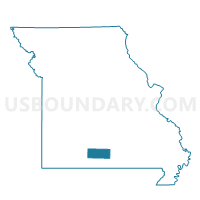
Jackson Voting District, Douglas County, Missouri
About
Outline

Summary
| Unique Area Identifier | 607750 |
| Name | Jackson Voting District |
| County | Douglas County |
| State | Missouri |
| Area (square miles) | 36.54 |
| Land Area (square miles) | 36.45 |
| Water Area (square miles) | 0.09 |
| % of Land Area | 99.75 |
| % of Water Area | 0.25 |
| Latitude of the Internal Point | 36.83255750 |
| Longtitude of the Internal Point | -92.37267880 |
Maps


Graphs
Select a template below for downloading or customizing gragh for Jackson Voting District, Douglas County, Missouri


Neighbors
Neighoring Voting District (by Name) Neighboring Voting District on the Map
- Brown Voting District, Douglas County, MO
- Brush Creek Voting District, Douglas County, MO
- Bryan Voting District, Douglas County, MO
- Champion Voting District, Douglas County, MO
- Jackson Voting District, Ozark County, MO
- McMurtrey Voting District, Douglas County, MO
- Richland Voting District, Ozark County, MO
Top 10 Neighboring County Subdivision (by Population) Neighboring County Subdivision on the Map
- Richland township, Ozark County, MO (794)
- McMurtrey township, Douglas County, MO (431)
- Brush Creek township, Douglas County, MO (397)
- Bryan township, Douglas County, MO (346)
- Jackson township, Ozark County, MO (300)
- Champion township, Douglas County, MO (269)
- Jackson township, Douglas County, MO (239)
- Brown township, Douglas County, MO (236)
Top 10 Neighboring Elementary School District (by Population) Neighboring Elementary School District on the Map
Top 10 Neighboring Unified School District (by Population) Neighboring Unified School District on the Map
- Mountain Grove R-III School District, MO (9,530)
- Ava R-I School District, MO (9,186)
- Gainesville R-V School District, MO (4,526)
- Dora R-III School District, MO (1,843)